
Hi all,
i’m exporting GeoTIFF using V9. The export is running and the tfw is ok. But when loading the generated GeoTIFF there is a displacement. (also checked with QGIS, same problem)
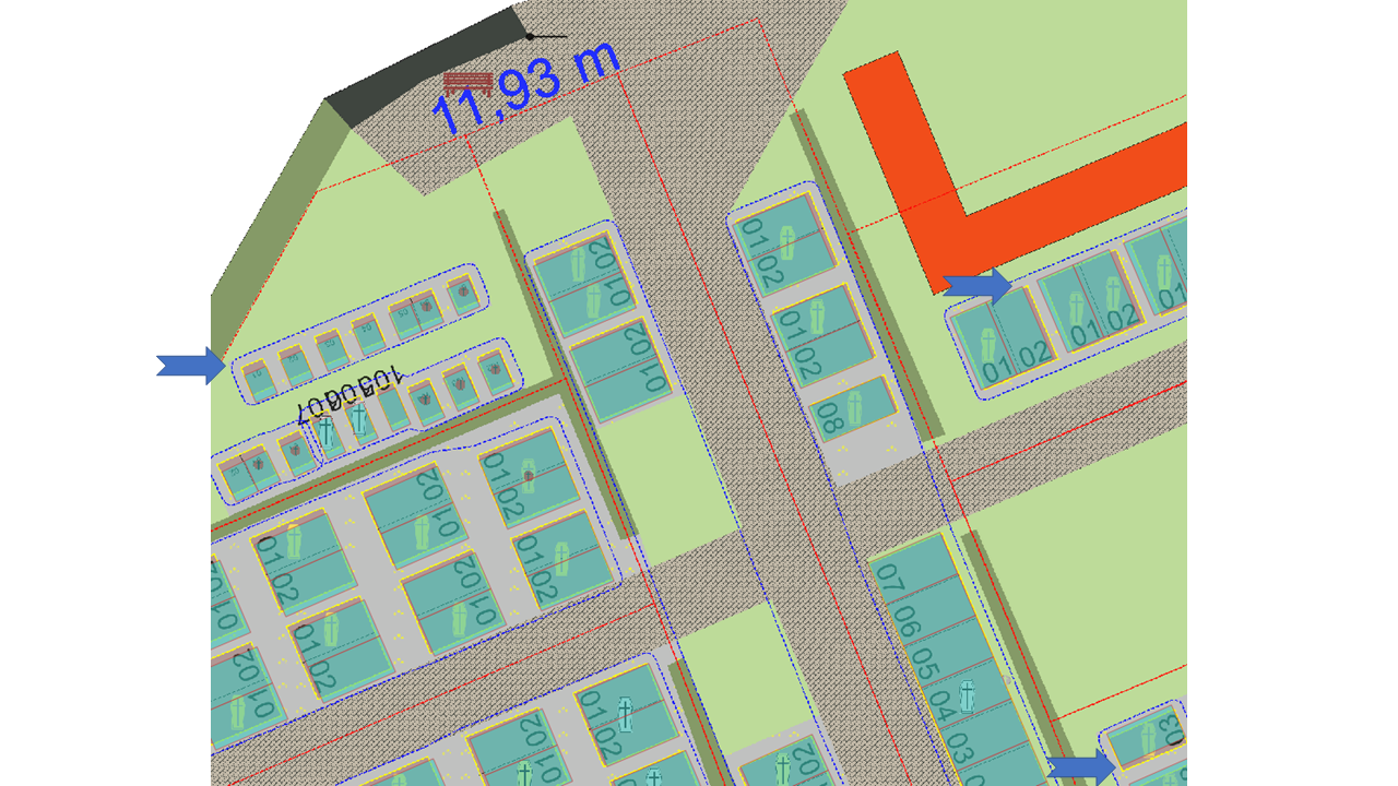
In the picture i have marked the displacement with blue arrows. The GeoTIFF seems to be streched.
For Export I’m using the GdiPlusGeoCanvas. I have tried to set the DPI Property (96, 100…) but the result is not correct.
The source Geometries are stored in PostgresFeatureLayer, projected with EPSG:25832.
 Dim g As Graphics = Graphics.FromImage(bitmap)
            ' Create a GdiPlusGeoCanvas and start the drawing
            Dim gdiPlusGeoCanvas As New GdiPlusGeoCanvas
            gdiPlusGeoCanvas.BeginDrawing(bitmap, ExportExtent.GetBoundingBox(), theMap.MapUnit)
            gdiPlusGeoCanvas.DrawingQuality = DrawingQuality.HighQuality
            'gdiPlusGeoCanvas.Dpi = 100

            ' Loop through all of the PrintingLayer in the PrinterInteractiveOverlay and print all of the
            ' except for the PagePrinterLayer
            Dim labelsInAllLayers As New Collection(Of SimpleCandidate)()
            For Each exportOverlay As LayerOverlay In theMap.Overlays
                    For Each exportLayer As ThinkGeo.MapSuite.Core.Layer In exportOverlay.Layers
                            If exportLayer.IsVisible Then 'GetLayerState(exportLayer.Name) > LayerState.invisible
                                exportLayer.Draw(gdiPlusGeoCanvas, labelsInAllLayers)
                            End If
                    Next
            Next

            ' End the drawing
            gdiPlusGeoCanvas.EndDrawing()
            bitmap.Save(filename, format)
How to get a correct GeoTIFF?
Regards
Hardy