
I just installed GIS editor for a try. How do i generate shapefile from the project?
How to generate shapefile
Hi rajanikanth,
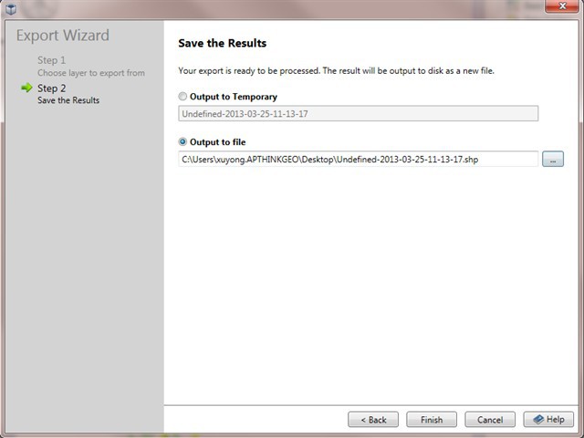
GisEditor provides the functionality that exporting to "ShapeFile" in several places, here shows how to export to a shapefile after loading a shapefile, drawing some features etc.
loading a shapefile and draw like:
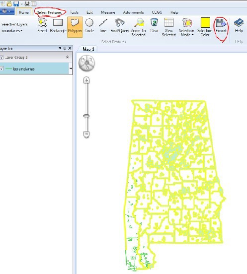
Switch to "Select Featuers" tab and then select the features you want to export by drawing a polygon, and then click "Export" shown in the picture below:
Hope it helps, if you have any different requirements, please feel free to let me know.
Thanks,
Johnny
I can export the feature layer wise from editor. When i open a saved shapefile in shapefile viewer it doesnt show any properties which i see in GIS editor.
Does the feature properties are also exported? if so what is the file and format? Is it a standard format? if i use different tool to create a map, will get the same information/properties in the same format? what about the labels?
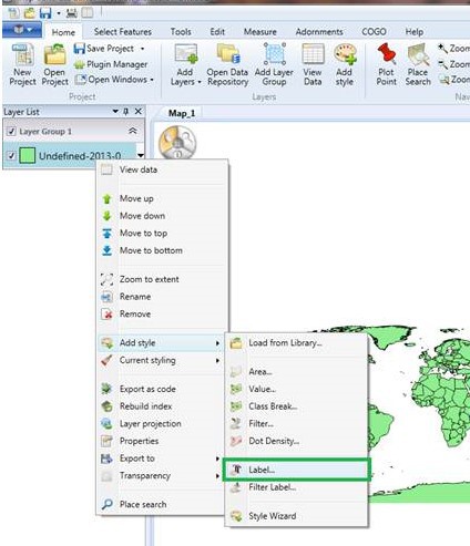
Yes, the feature properties are also exported, all these will be save into "shapefile .dbf" file, it's a standard shapefile format including ".shp, .shx and .dbf", all these information can be read by other tools which support shapefile format. "Labels" will also be saved as a column in ".dbf". if you would like to display them pleae following the picture shown below:
Thanks,
Johnny
I got chance to look into your suggestion.
I just followed your steps. Still when I open saved shape files in Map suite explorer 5.0, I don’t see the colors which I was able see in GIS editor.
Am I missing something?
Hi,
I think we might be not at the same page. I guess you want to export the styles binding with the shape file like the label color or background color. If yes, I am afraid it can be, as the shape file is the standard shape file from ESRI and there is no any styles information in it. That’s why there is no styles when you load the shape files with Map suite explorer.
All the styles should be set by view or codes. In Gis Editor, it support to export the current styles as codes or file. Please have a look at the “Export as code” item in the above image.
If there is anything confused, please feel free to let us know.
Regards,
Johnny