Hi Muneswar,
Thanks for your question!
If you need to zoom in closer than the scales provided by the default ZoomLevelSet you can setup a new ZoomLevelSet that uses the scales you desire. Below is a sample where I retained the stock scales for ZoomLevels01 to 16, but replaced ZoomLevels17 through 20 with my own values.
ZoomLevelSet customZL = new ZoomLevelSet();
customZL.ZoomLevel01.Scale = Map1.ZoomLevelSet.ZoomLevel01.Scale;
customZL.ZoomLevel02.Scale = Map1.ZoomLevelSet.ZoomLevel02.Scale;
customZL.ZoomLevel03.Scale = Map1.ZoomLevelSet.ZoomLevel03.Scale;
customZL.ZoomLevel04.Scale = Map1.ZoomLevelSet.ZoomLevel04.Scale;
customZL.ZoomLevel05.Scale = Map1.ZoomLevelSet.ZoomLevel05.Scale;
customZL.ZoomLevel06.Scale = Map1.ZoomLevelSet.ZoomLevel06.Scale;
customZL.ZoomLevel07.Scale = Map1.ZoomLevelSet.ZoomLevel07.Scale;
customZL.ZoomLevel08.Scale = Map1.ZoomLevelSet.ZoomLevel08.Scale;
customZL.ZoomLevel09.Scale = Map1.ZoomLevelSet.ZoomLevel09.Scale;
customZL.ZoomLevel10.Scale = Map1.ZoomLevelSet.ZoomLevel10.Scale;
customZL.ZoomLevel11.Scale = Map1.ZoomLevelSet.ZoomLevel11.Scale;
customZL.ZoomLevel12.Scale = Map1.ZoomLevelSet.ZoomLevel12.Scale;
customZL.ZoomLevel13.Scale = Map1.ZoomLevelSet.ZoomLevel13.Scale;
customZL.ZoomLevel14.Scale = Map1.ZoomLevelSet.ZoomLevel14.Scale;
customZL.ZoomLevel15.Scale = Map1.ZoomLevelSet.ZoomLevel15.Scale;
customZL.ZoomLevel16.Scale = Map1.ZoomLevelSet.ZoomLevel16.Scale;
customZL.ZoomLevel17.Scale = 750;
customZL.ZoomLevel18.Scale = 500;
customZL.ZoomLevel19.Scale = 250;
customZL.ZoomLevel20.Scale = 100;

Map1.ZoomLevelSet = customZL;
Important: If you have other Layer objects that you want to follow same ZoomLevels as your Map you need to be sure to apply your new ZoomLevel to EACH of those layers. Setting the Map's ZoomLevelSet does not cause the Layers that are added to the Map to use the same ZoomLevelSet, you MUST set this for each Layer object or you will get unexpected results.
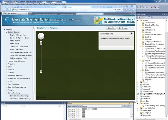
Here is a screen shot where I zoomed in to a MrSid image down to a scale of 100: