ThinkGeo.com    |     Documentation    |     Premium Support

Jpeg2000RasterLayer wrong display of image color space ( blue scale)

Hallo,
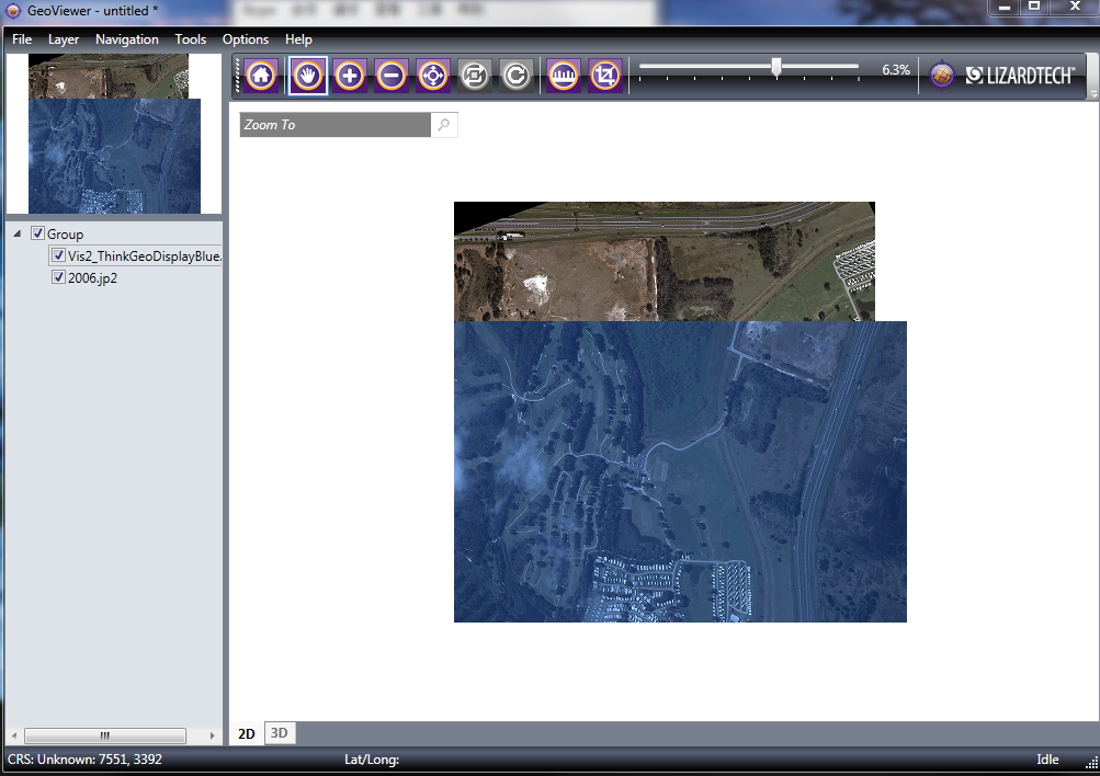
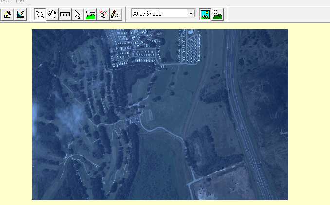
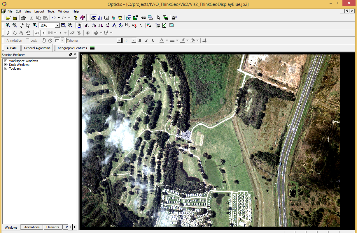
I am trying to open JPeg200 files by using Jpeg2000RasterLayer
we are having some problems with the color space in the image. The files are 8bit format
Attached 2 files:

  • “Vis2.jp2” - color space is wrong (appears as “blue scale”)
  • “2006.jp2” - color space is correct and valid

I attached a screenshot of the images (in PNG format), because the original files are big.

Can I send you the original JP2 images (~70Mb)?
Can you explain, why some of the images are displayed correctly, and some not?
Does the problem caused by different JP2 formats?
Maybe you are able to direct us to some problem we have, in the JP2 format/parameters/ metadata?
Any help will be much appreciated, as this are files from our costumer, which the Jpeg2000RasterLayer does not display correctly.

Thank you in advanceVis2_PNG.zip (2.5 MB)Uploading…

Hi Shlomo,

If you want to sent us your sample data, you can contact your sales to get an account of our FTP, and let us know after you upload it. Or you can put that in some network disk and sent us the download link.

We support JPEG2000 format via 3rd part dll from Lizard, so we need to make sure whether it’s supported by their dll.

Regards,

Ethan

Thank you, the smaple files are in the following link

Hi Shlomo,

Thanks for your data, I download it today and test it by the GeoViewer, which is built by our JPEG2000 library provider.

And as below is the test result:

And I tested it by the other utility globalMapper, the result looks the same:

So I think the data should just be how it rendered.

Regards,

Ethan

The data should NOT be rendered in blue scale. The original image colors can we seen in the file called “Vis2_OriginalGood_PNG.png” - this is a screen shot from another application called “Opticks”. I used “Optics” to open the JP2 image, and their the colors are good.
I attached another screen shout from Optics application in here.

Maybe the globalMapper display the blue image because they also use similar methods to the one used by your 3rd party dlls. but the fact is that the colors are still wrong

My question is way the colors are wrong?
Can you provide detailed specification for the JP2 format that your 3rd party dlls support?
As you can see some files are been rendered correctly, as can be seen in the “Vis2” image. So I guess there is a format/metadata difference?
It is critical for me to know, what is the problem of that image so I will be able to tell my costumer to supply JP2 from the required type.

Thank you in advance

Hi Shlomo,

Today we tested QGIS, it’s just get the same result.

Because all the utilities we tested are face to GIS, but the utility Opticks is a remote sensing and imagery analysis software platform, it’s more professional. So I think the jp2 image should be just like what we rendered, the Opticks did special handle for it to remove the blue cover layer.

You can find more utility to make sure what’s the default image it looks like.

Here is some FAQ from our JP2 support, http://doc.lizardtech.com/files/geo/techinfo/JPEG_2000_FAQ.pdf

If you want to find more information about how they render JP2 you can search on their website.

Wish that’s helpful.

Regards,

Ethan