ThinkGeo.com    |     Documentation    |     Premium Support

Problem with ECW Maps

Hi there,

I have a problem with displaying ecw maps after zoom. If i zooming into the map the whole map distorts.
I add two screenshots here.

And after the zoom

I try to upgrade my map program from Map Suite 7 to Map Suite 9 , because of memory problems from Map Suite 7 with ECW maps.

Are there any ideas to solve that stuff?

A wierd aspect for my problem is, the zoom at the corners of the ecw map. There´s no distortion.

If more information is needed, please let me know.

Regards,
Marco

Hi Marco,

It looks like the width/height ratio problem when render the ECW file.

Our developer need your ECW file for reproduce that, and please let us know your test bounding box.

BTW, any further information should be helpful like the dll detail version.

Thanks,

Hi Don,

I use the last full production build 9.0.0.401 of Map Suite. I have to use a 3-degree Gauss-Kruger coordinate system. EPSG code is 2398 .
Problem now, I cant upload the map, it´s to big (over 250 MB). Do you have other ways to upload files?

Regards,

Marco

Hi Marco,

Please contact your sales to get an FTP account, then please let me know what’s the folder name you uploaded.

And you can paste the test code snippet in this post.

Regards,

Don

Hi Don,

I uploaded two ecw map files to the folder “ECW Map”.

Regards,

Marco

Hi Marco,

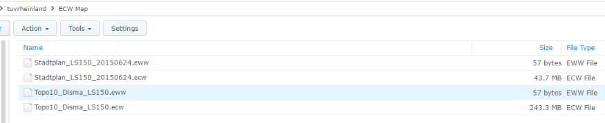
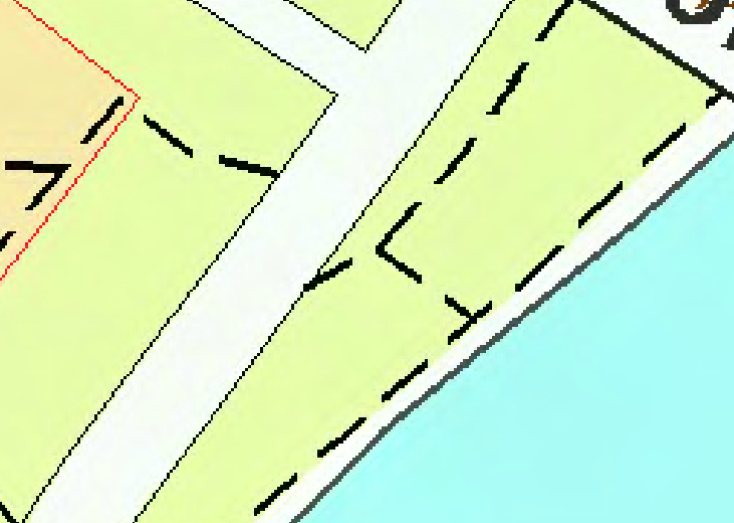
Thanks for providing the test data. To make sure It’s what you provided, just outline the file as below picture:

I tried both ECW files with the code as following:

        winformsMap1.MapUnit = GeographyUnit.DecimalDegree;
        winformsMap1.BackgroundOverlay.BackgroundBrush = new GeoSolidBrush(GeoColor.GeographicColors.ShallowOcean);

        EcwRasterLayer ecwImageLayer = new EcwRasterLayer(@"C:\Working Projects\Data\ECW Map\Topo10_Disma_LS150.ecw");
        //EcwRasterLayer ecwImageLayer = new EcwRasterLayer(@"C:\Working Projects\Data\ECW Map\Stadtplan_LS150_20150624.ecw");
        ecwImageLayer.UpperThreshold = double.MaxValue;
        ecwImageLayer.LowerThreshold = 0;

        ecwImageLayer.Open();
        winformsMap1.CurrentExtent = ecwImageLayer.GetBoundingBox();
        ecwImageLayer.Close();

        LayerOverlay imageOverlay = new LayerOverlay();
        imageOverlay.Layers.Add("EcwImageLayer", ecwImageLayer);
        winformsMap1.Overlays.Add(imageOverlay);

        winformsMap1.Refresh();

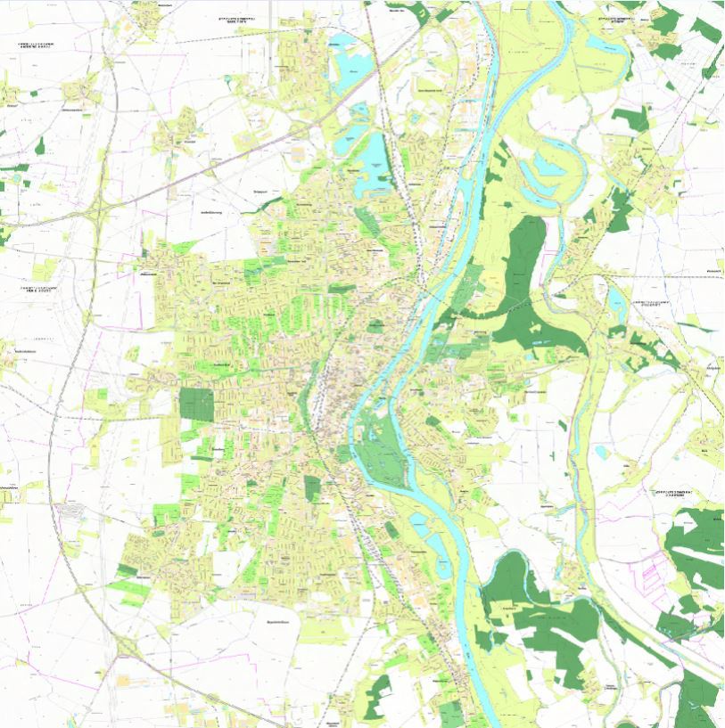
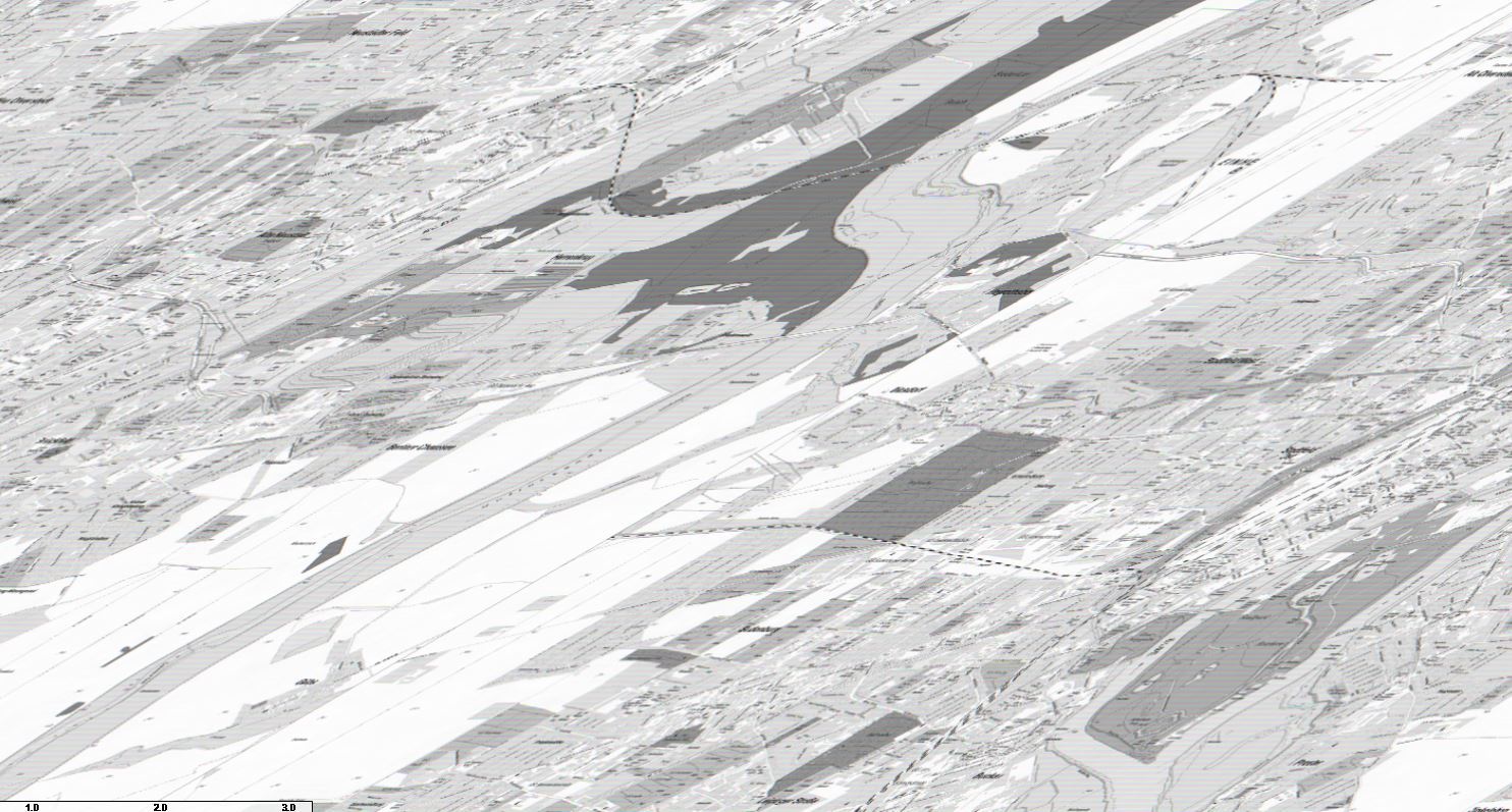
but all works fine, including by default and after zoomed-in. Please see the first picture below is the default view and the second is zoomed-in.

All these tests are on a brand-new machine with Windows 10 installed. I downloaded the public release “Map Suite Product Center” from official website, and activated the license to download the FULL PRODUCT 9.0.0.401.

Would you please do a double-verify to see how it works on your side?

Thanks,
Johnny