Hi @Ethan
I posted a map service for WMTS. i use a WmtsLayer to show map, but there is nothing show.
i upload the sever info file.
severinfo.xml (9.2 KB)
Can you help me see what’s wrong? Thank your very much.
Regards
ZhangMing

Hi @Ethan
I posted a map service for WMTS. i use a WmtsLayer to show map, but there is nothing show.
i upload the sever info file.
severinfo.xml (9.2 KB)
Can you help me see what’s wrong? Thank your very much.
Regards
ZhangMing
Hi ZhangMing,
I hadn’t found incorrect code from your image.
Because your server is a local server, so we cannot test whether that can works. If you cannot see the map, I think you can get the single tile request uri first, then to modify each parameters to make it render the single tile at first, and adjust the parameter in your code after that.
And as below is some sample code to render WMTS, wish that’s helpful.
        WmtsLayer wmts = new WmtsLayer(new Collection<Uri> { new Uri("http://xxxxx") });
        wmts.SendingWebRequest += Wmts_SendingWebRequest;
        wmts.AxisOrder = WmtsAxisOrder.YX;
        wmts.WmtsSeverEncodingType = ThinkGeo.MapSuite.Layers.WmtsSeverEncodingType.Kvp;
        wmts.TileMatrixSetName = "EPSG:4326";
        wmts.ActiveLayerName = "mylayer";
        wmts.ActiveStyleName= "default";
        wmts.OutputFormat = "image/png";
Wish that’s helpful.
Regards,
Ethan
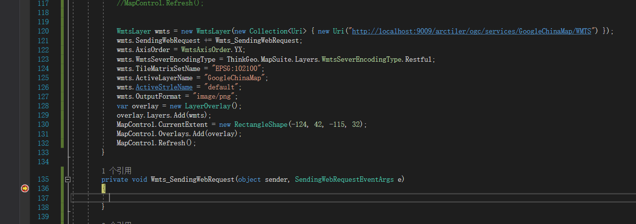
Hi @Ethan
i use your code like this
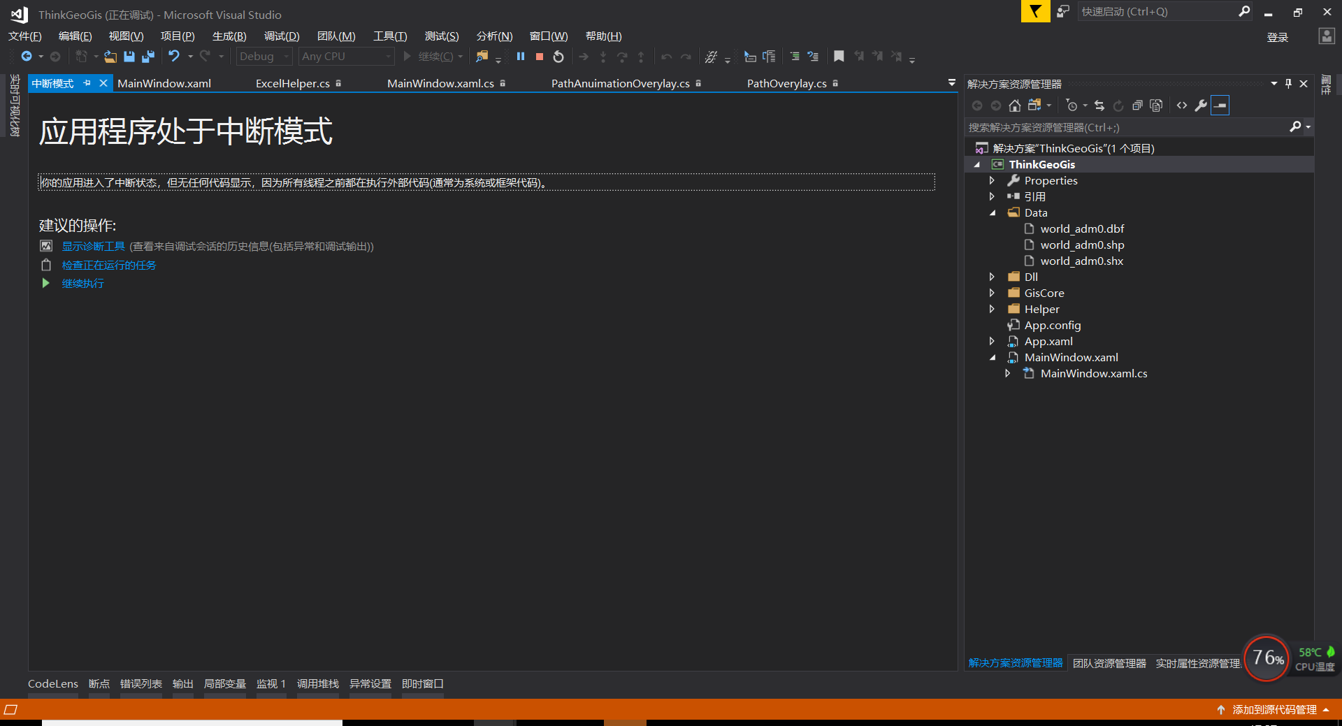
But when I go on running, I got such a mistake as the following
The application is in the interrupt mode.
Regards
ZhangMing
Hi ZhangMing,
Please show us the detail error if possible.
And please make sure you need the AxisOrder and WmtsServerEncodingType parameters, I am not sure whether your server need that.
Regards,
Ethan