
I develop an application for tracking vehicles. I use Winforms for the app, but the map is WPF. I have a problem. There is an overlay just for the vehicles. This overlay has many layers each for every vehicle. Every layer has one pointshape with pointstyle and textstyle for the image and the label. I have used clustering too. The problem is that many of the labels (and sometimes the images) are cut. You can see the problem in the picture below. I had used the same code for winforms and worked without this problem. But we decide to use WPF for other reasons.
Pointshape's label problem
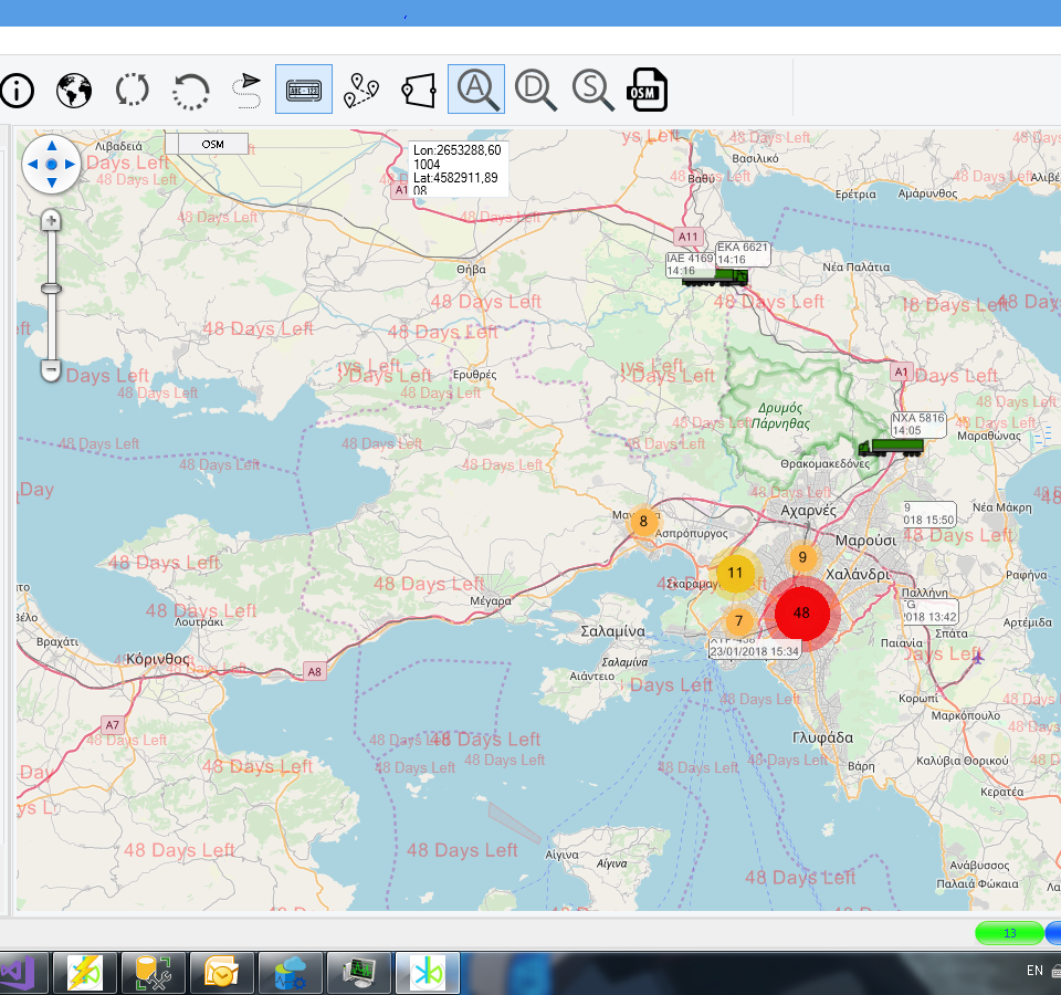
Hi Marios,
What’s the layer of the type where your cut label is plotted?
We set multiply tiles for improve performance, but for label layer, you can put the layers into an overlay whose tile type equal TileType.SingleTile, I think it can solve the cut problem.
And you can try to set a bigger layer.drawingMarginInPixel, the default value is 50, you should want to set a bigger value, this property will reduce performance also, because it will draw extra area.
Regards,
Ethan