Hi @Ethan ,
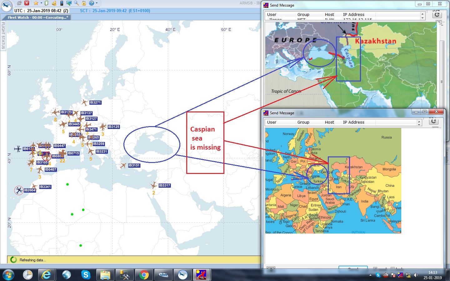
For our Desktop application we are using Countries02.shp shape file as base map. In that we have observed that Caspian sea is missing, instead of that it is covered with Earth. Please look at the following screenshot for the problem.
I hope you will understand the problem from the above screenshot.
So please give us the latest and correct Countries shape file…
Thank you,
Ethan
January 30, 2019, 9:21am
2
Hi Ashok,
This data is just work for demo, it only shows the rough outline of countries, so the border of any water in plate is not included.
If you want to get a exactly base map for product but not demo, I think this shape file is not a good choice.
There is a website Natual Earth which provide good data, you can try to download more precise data from it.
Regards,
Ethan
Ok Mr.Ethan, thanks for the valuable information.
Regards
Ethan
January 31, 2019, 2:33am
4
Hi Ashok,
Any question please let us know.
Regards,
Ethan