
Hi,
When using GeoImage as PointStyle on ThinkGeo WPF maps, there are some visible rendering artifacts sometimes.
I followed the quick start instructions at https://gitlab.com/thinkgeo/public/thinkgeo-desktop-maps to implement the basic map application. Then I made a small change to change the capital point style to load a PNG file as GeoImage. The Visual Studio project is attached as ZIP file for reference.
ThinkGeoWpfApp.zip (44.1 KB)
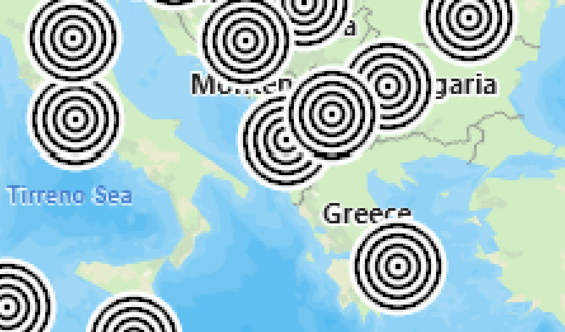
There seem to be some duplicated pixel lines or columns here and there and the artifacts are sometimes more or less visible at different zoom levels. It looks like the artifacts might occur at the tile borders? See below close-up picture for reference, pixels get duplicated on the horizontal line that intersects at least three GeoImages:
Is this a known problem and is there some way to get around it?
BR, Rasmus