ThinkGeo.com    |     Documentation    |     Premium Support

GeoTif displays very dark

Hi,

We are having trouble with some of our new GeoTiffs. They appear OK when viewed in ArcMap but are too dark in out ThinkGeo based application.

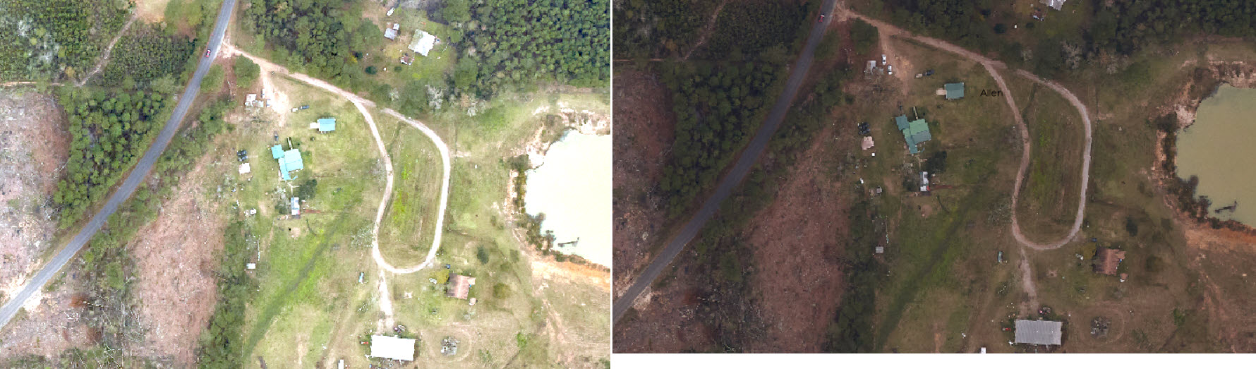
I have attached a screenshot so you can see the difference. The darker one is from our ThinkGeo application and the lighter one comes from ArcMap. Is there a way to make it display lighter in ThinkGeo? I can send the original file if necessary, but it’s very large.

Thanks!

Steve

Thanks Steven,
Yes. We do support add bright to the geotiff layer
geoTiffRasterLayer.GreenTranslation = 100;
geoTiffRasterLayer.RedTranslation = 100;
geoTiffRasterLayer.BlueTranslation = 100;

Thanks

Frank

Frank,

Thanks so much for the tip! What are the valid values of Red/Green/Blue translation? How do they all work together? Is it the higher the number the lighter the color or the other way around?

Thanks!

Steve

Yes Steven,
Base on this document.
https://www.graphicsmill.com/docs/gm/brightness-and-contrast.htm

Bitmap brightness is the degree of pixel intensity. For brevity let’s assume that we are working with a grayscale bitmap. If most pixels of this bitmap have small values (e.g. close to 0), the bitmap is called dark . Vice versa, if most pixels have large values (e.g. close to the maximum value - 255 for 8-bit images, and 65355 for 16-bit images), the bitmap is called bright .

I tested the validate value should be 0 to 255. You can add 3 trackbars to your UI and bind the value with the Red/Green/Blue translation and play with different value until get the best result.

Thanks

Frank