ThinkGeo.com    |     Documentation    |     Premium Support

Installing WMS Server on IIS 7

Hi,


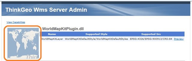
I am working on a project to create our own wms server in which we add our own customized data to display on the map over the internet. I have downloaded map suite wms server edition, and went thru the quickstart guide. As said in the guide, I set the templates to ".NET Framework 3.5 for the project. After building and debugging the project, I installed the wmspluginservice to IIS 7 on my localhost with defaultapplication pool set to.NET Framework v2.0.50727. I am able to publish the map with our own data on it at my localhost. But the problem is that when I copy the wmspluginservice inside inetpub\wwwroot in our test server and create a web application on IIS7 and browse for the application, the admin page appears but when I click to preview the maps, pink tiles appear not showing the world map on the browser. 


Do I need to modify the web.config file to include the paths for shapefiles of our own data inside <appSettings>?


In the test server the IIS 7, has the default application pool as .net version 4. So, i created another application pool for. .NET Framework v2.0.50727such that the wmspluginservice uses this. Is the problem of pink tiles appearing related to this?


I cannot figure out the problem for pink tiles appearing on the map.I need to solve this issue asap. 


I also wanna know if thinkgeo supports openlayers and if there are any documentation/references showing how. Since I want to display this wms with openlayers.


I will be very appreciative if you could help me solve this problem. 


Best Regards


 Hello Rumeysa,


I do the test following your description using VS2010 with framework 3.5, and deploy the IIS7 with framework 2.0, but my debugging and application on IIS7 both are works well. Actually, in the plugin dll, I try to change the data path to point a invalid one, it shows the pink tiles, but it’s right. So I wonder the framework version is correct for the work, and it’s not  about the web.config, you should check your data path carefully when you want to set the data file to other places. Or maybe sometimes you should refresh your browser time after time until getting the exact page.
 
As the openlayers, our all web products support it, and you can get the details at this link:  download.thinkgeo.com/docs/mvc/clientapi/
 
Regards,
 
Gary

Hi Gary, 
  
 Thanks so much for the detailed reply and for your time. The directory path written in the code at my localhost is same as the one in test server. So inside the dll file,the file path is exactly addressing the path for the shapefiles in the test server. (I copied these folders to the same locations in the test server.) But, still pink tiles continue to appear.Apart from this, refreshing the browser does not work since I have tried that so many times. So, i still could not solve the issue. 
  
 I also used your method of testing where I gave an arbitrary file path to the file in the code, built and debugged it and deployed it in IIS 7. Pink tiles also appeared on mine. I recorrected the code by changing the file path to the correct one, built, debugged and redeployed the project developed in visual studio 2010 with framework 3.5 in iis 7 with framework 2.0. By browsing thru the iis 7, now it started giving me pink tiles when i click to preview the world map kit. The simple map is working fine. I do not understand what the matter is.   
  
 Sorry for bothering you with those simple stuff, but these are really annoying. They keep me away from getting my hands on the project which is to actually set up the map server to display our customized map data thru openlayers.

Hi Rumeysa,


When you go to the 'Admin' page of your WMS server do you also get pink tiles, or does the map render as shown below?


Perhaps the path to your map data is a protected directory? The root or C:\ on Windows 2008 and newer is not a location that Microsoft makes easy to access. Can you attempt to place some of your map data on a separate drive or a folder that you have assigned access to?


Thanks a lot for the replies. We solved the problem. 
  
 I have set up my wms server in a server machine that has windows 2008 r2 operating system installed in it.My map data files are placed in a folder located at c:. (There is only c: drive on the server machine) I installed the visual studio 2010 version to the server and debugged the code to see  if the files can be read from the path. There is no problem with that. But, we realized that the dll files had to have strong names. So, we created strong names for the thinkgeo dll files used in the project and also for the hellowmsplugin. That solved our problem. Now, the plugin is successfully deployed in the IIS on the server and we can see the map.

Hi Rumeysa,  
  
 Glad to hear you found a resolution!