ThinkGeo.com    |     Documentation    |     Premium Support

Loading ESRI portal feature services

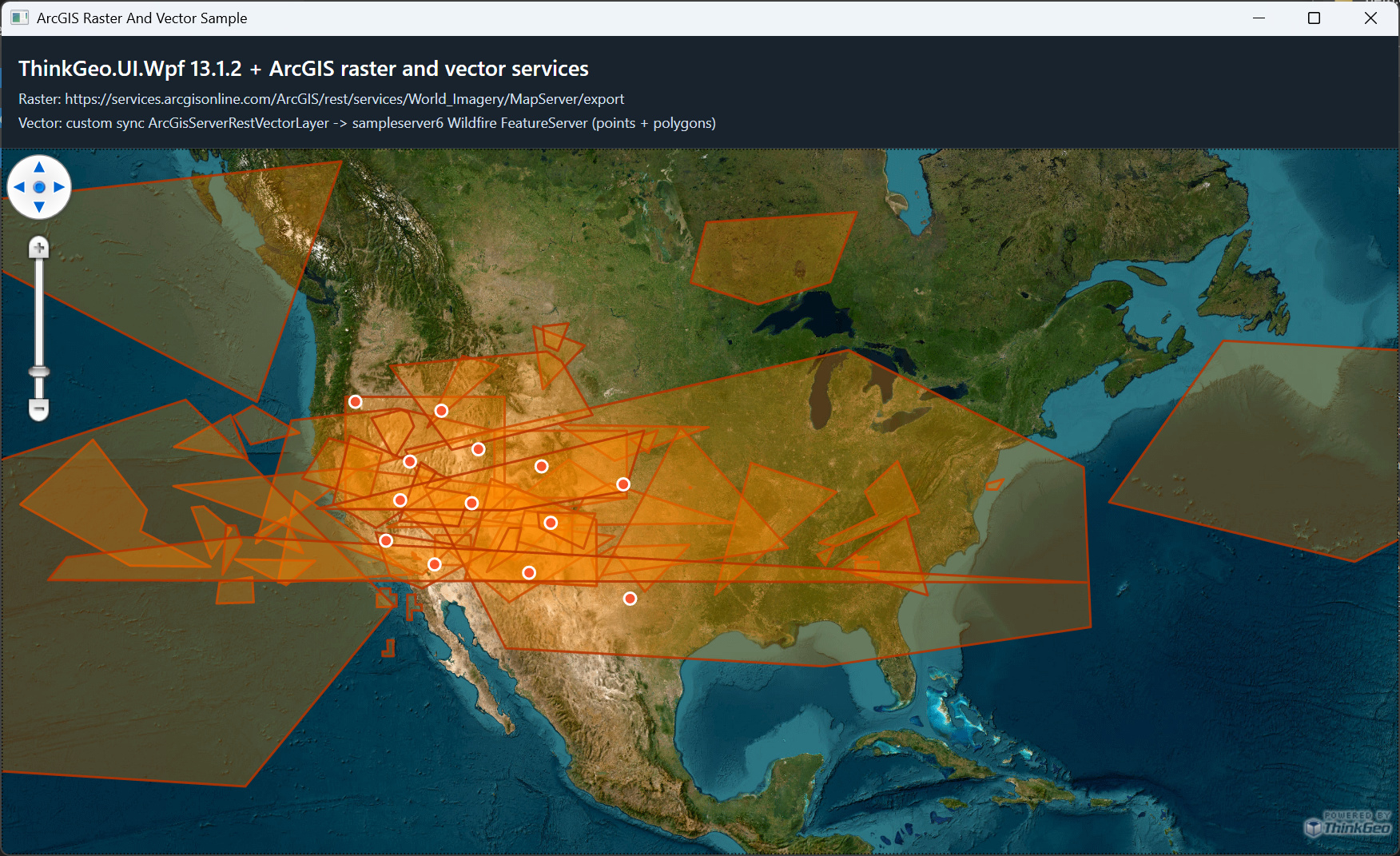
Is it possible in v13.1.2 to load layers from an esri portal feature service? I managed to get map and image services working using your ArcGISServerRestLayer, but haven’t had luck with feature services. I see in the lastest release notes, https://docs.thinkgeo.com/products/desktop-maps/changelog/, it says you " Added ArcGisServerRestVectorAsyncLayer for querying and rendering ArcGIS Server REST vector feature services."

Does that mean the feature doesn’t exist in earlier versions?

Sorry, ArcGisServerRestVectorAsyncLayer is built on an async framework that was introduced after v13.1.2, so it’s not something we can easily port over and make work in earlier versions. I’d suggest you upgrading to the latest version, let us know any issues you have, and we are happy to help.

Hi Ben, thanks for the response. Just to be clear, there’s not a non-async version somewhere in older versions right? Do you have a recommended way to load layers from arcgis feature services? My plan right now is to just retrieve the layers’ geojson and feed that into thinkgeo’s api.

right, there was no non-async version in older versions.

So you were using ArcGisServerRestAsyncLayer, and plan to replace it with the vector version? Are you displaying it on the map, or going to print it out, or save it to an image? Let me know a bit more about how you gonna use this layer and I’ll see what we can do for you.

Basically we are just letting users pick some layers from an arcgis map/image/feature service and load them on the map. In the case of raster layers (or a feature layer in a map service exported as an image), I got it working by using ArcGISServerRestLayer. What I couldn’t get working was displaying the feature layers as vector layers with their fields, which is where I was just going to retrieve the geojson and load them into an InMemoryFeatureLayer probably.

This is all for display purposes only on the map, no editing the features or anything like that.

Hi Dan,

We created a Non-Async ArcGis vector layer for you based on v13.1.2. Here the demo below shows ArcGis Raster and Vector on the same map, please take a look.

ArcGisRasterServiceSample.zip (10.0 KB)

Thanks,
Ben

Thanks Ben! That’s some nice work, I can definitely use this.

Awesome! Let me know if you have any other questions.