Hi Ben,
Thanks for the update on the ZoomLevel system, that kind of reinforces what I discovered yesterday.
The data we are working with is vector stuff from SHP files.
We have 3 SHP files:-
ABCWorldSmall - 2 Mbytes Index = 114k 1,764 records
ABCWord - 22 Mbytes Index = 1.5 Mbytes 26,939 records
ABCWorldLarge - 92 Mbytes Index = 11 Mbytes 180,685 records
These are somewhat specialised files as they are just the world coastlines in differing levels of detail. They do not contain country information just the coastlines basically split into 4 areas by the Panama Canal (North and South America) and the Suez Canal (Africa and NW Europe/Russia/Asia).
Done this way so we can have a clean world map, no country borders but a sharp single pixel line representing the coastline, with the land area in a slightly lighter colour, seel below
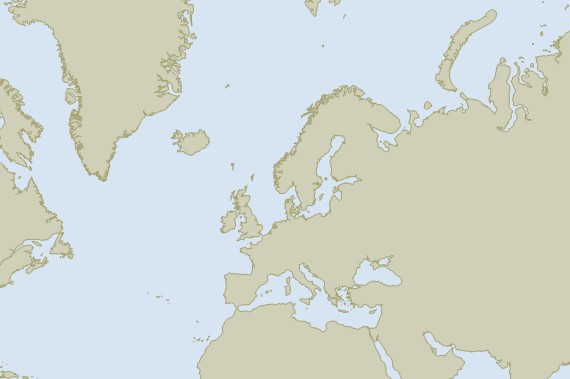
In the large map, apart from loads of islands, this results in 5 large single shape records representing the five large continental masses at a reasonably high resolution (WVS at full scale)
We have set the zoomlevels to 1-5 for the small 6-12 for the medium map and 13-20 for the big one.
In our previous system this displayed very quickly at whatever scale, in ThinkGeo things start grinding to a halt as you go from zoomlevel 15 onwards with zoomlevel 20 taking about 10 seconds to redraw. Incidentally indexing the big layer takes about 5 minutes on my machine.
I guess it must be struggling with the shear size of that one shape that represents the Asian continent.
Happy to send the files in if this helps…
Regards
John

