
Using Silverlight Edition 4.0.0.0 (file version 4.0.48.0) I'm having problems display polygons from shapefiles correctly at certain zoom levels.
I believe this may be a clipping issue - when I zoom into polygon D below, at zooms levels 16-18 (assuming 1 is the whole world, and a single mouse scroll goes in one level, with a Google maps background) the Polygon 'flips', and the outside become shaded and the inside unshaded, as shown below:
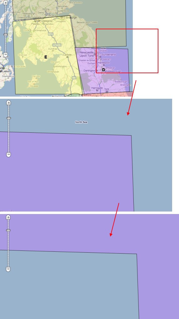
This is entirely repeatable, and happens on many shapes and sizes of polygons. I haven't confirmed that it's always at exactly the same level, but it is always when fairly zoomed in.
The polygons being shown are in mercator co-ordinates in a shapefile (via a ShapeFileFeatureSource), and are in the attached zip.
Depots.zip (1.7 KB)