Hi Ben,
I think I was able to reproduce the issue in your demo project.
In our project my colleague added some mapview settings. One of these settings is causing an issue since version 061. I hope this helps to find the problem and a solution.
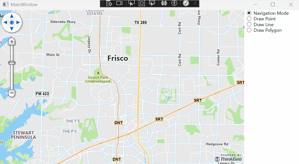
In this video you can see the issue in your demo project:
This is the MapView_Loaded function with the issue in your demo project:
Private Async Sub MapView_Loaded(sender As Object, e As RoutedEventArgs)
' Set the map's unit of measurement to meters (Spherical Mercator)
MapView.MapUnit = GeographyUnit.Meter
' Add Cloud Maps as a background overlay
Dim thinkGeoCloudVectorMapsOverlay As New ThinkGeoCloudVectorMapsOverlay With {
.ClientId = "AOf22-EmFgIEeK4qkdx5HhwbkBjiRCmIDbIYuP8jWbc~",
.ClientSecret = "xK0pbuywjaZx4sqauaga8DMlzZprz0qQSjLTow90EhBx5D8gFd2krw~~",
.MapType = ThinkGeoCloudVectorMapsMapType.Light}
MapView.Overlays.Add(thinkGeoCloudVectorMapsOverlay)
' Set the map extent
MapView.CurrentExtent = New RectangleShape(-10786436, 3918518, -10769429, 3906002)
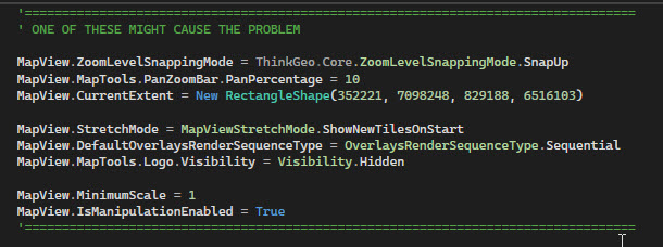
'==================================================================================
' ONE OF THESE MIGHT CAUSE THE PROBLEM
MapView.ZoomLevelSnappingMode = ThinkGeo.Core.ZoomLevelSnappingMode.SnapUp
MapView.MapTools.PanZoomBar.PanPercentage = 10
MapView.CurrentExtent = New RectangleShape(352221, 7098248, 829188, 6516103)
MapView.StretchMode = MapViewStretchMode.ShowNewTilesOnStart
MapView.DefaultOverlaysRenderSequenceType = OverlaysRenderSequenceType.Sequential
MapView.MapTools.Logo.Visibility = Visibility.Hidden
MapView.MinimumScale = 1
MapView.IsManipulationEnabled = True
'==================================================================================
' Create the layer that will store the drawn shapes
Dim featureLayer As New InMemoryFeatureLayer()
' Add styles for the layer
featureLayer.ZoomLevelSet.ZoomLevel01.DefaultPointStyle = PointStyle.CreateSimpleCircleStyle(GeoColors.Blue, 8, GeoColors.Black)
featureLayer.ZoomLevelSet.ZoomLevel01.DefaultLineStyle = LineStyle.CreateSimpleLineStyle(GeoColors.Blue, 4, True)
featureLayer.ZoomLevelSet.ZoomLevel01.DefaultAreaStyle = AreaStyle.CreateSimpleAreaStyle(GeoColors.Blue, GeoColors.Black)
featureLayer.ZoomLevelSet.ZoomLevel01.ApplyUntilZoomLevel = ApplyUntilZoomLevel.Level20
' Add the layer to a LayerOverlay
Dim layerOverlay As New LayerOverlay()
layerOverlay.Layers.Add("featureLayer", featureLayer)
MapView.Overlays.Add("layerOverlay", layerOverlay)
AddHandler MapView.TrackOverlay.TrackEnded, AddressOf TrackOverlay_TrackEnded
popupOverlay = New PopupOverlay()
MapView.Overlays.Add(popupOverlay)
Await MapView.RefreshAsync()
End Sub
Regards,
Guido van den Boom

 All right, the issue now has been fixed in beta 78, pull the latest and have another try.