
Hi all,
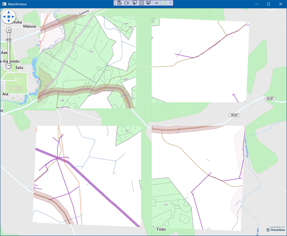
I’ve been trying to take Latest ThinkGeo (13.1.0-beta026) in use. It looks to be otherwise working ok but I’m now experiencing pretty bad rendering problems. The rendered images are missing parts and when changing zoom level the missing parts may be different.
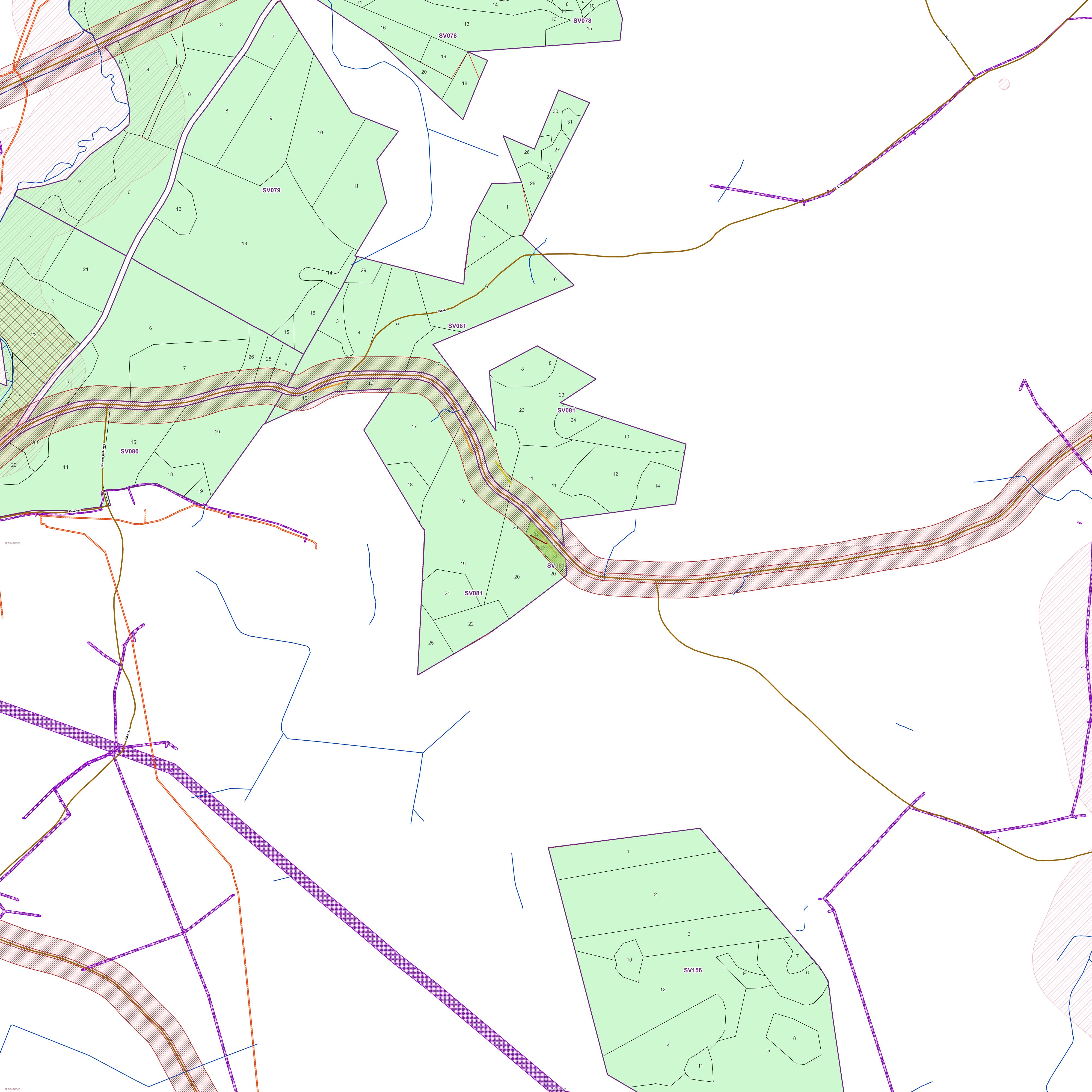
Here’s an example with jpg raster.
The world file content:
0.5000
0
0
-0.5000
661912.622
6440502.055
Here’s the example code:
LayerOverlay myOverlay = new LayerOverlay();
wpfMap.Overlays.Add(myOverlay);
NativeImageRasterLayer layer = new NativeImageRasterLayer(LR_SV081_32, Path.ChangeExtension(LR_SV081_32, "jpgw"));
myOverlay.Layers.Add(layer);
layer.Open();

string internalProjString = "+proj=lcc +lat_1=59.3333333333333 +lat_2=58 +lat_0=57.5175539305556 +lon_0=24 +x_0=500000 +y_0=6375000 +ellps=GRS80 +towgs84=0.0,0.0,0.0,0.0,0.0,0.0,0.0 +units=m +no_defs ";
string externalProjString = @"+proj=merc +a=6378137 +b=6378137 +lat_ts=0 +lon_0=0 +x_0=0 +y_0=0 +k=1 +units=m +nadgrids=@null +wktext +no_defs +type=crs";

var converter = new UnmanagedProjectionConverter(internalProjString, externalProjString);
converter.Open();
layer.ImageSource.ProjectionConverter = converter;

wpfMap.CurrentExtent = layer.GetBoundingBox();
layer.Close();

wpfMap.Refresh();
Any ideas?
Best Regards,
Jarno