
I’m not familiar with projection.
And i didn’t find “Documentation” folder under installation folder (C:\Program Files (x86)\ThinkGeo\Map Suite 9.0…)
The problem is that, There is an .shp file along with it’s .prj file which has this peace of text in it: PROJECTION["Transverse_Mercator"].
This .shp file should be shown on top of the openstreetmap.
And the following code do the projection:
map.MapUnit = GeographyUnit.Meter; ManagedProj4Projection utmToEpsg3857 = new ManagedProj4Projection(2059, 3857); utmToEpsg3857.Open(); cityLayer.FeatureSource.Projection = utmToEpsg3857;
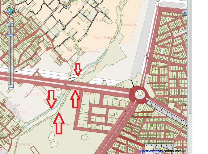
But this shape layer (cityLayer) does not correctly match on top of the OpenStreetMap.
I also confirm that the mapunit is set to meter.
Am i missing something?

