ThinkGeo.com    |     Documentation    |     Premium Support

Some Questions how to use WfsV2FeatureLayer

Hallo,

i try to use some WFS Layers in germany-saxonia (ThinkGeo Version 14.3.1) with the following code:

 string serviceLocationUrl = @"https://luis.sachsen.de/arcgis/services/luft/tierhaltung_wfs/MapServer/WFSServer";
 string typeName = "tierhaltung_wfs:Tierhaltung";

 wfsV2FeatureLayer layer = new WfsV2FeatureLayer()
 {
     WebProxy = proxy,
     ServiceLocationUrl = serviceLocationUrl,
     TypeName = typeName,
     TimeoutInSeconds = 500
 };

 layer.ZoomLevelSet.ZoomLevel01.DefaultPointStyle = PointStyle.CreateSimplePointStyle(PointSymbolType.StarCircled, GeoColors.Black, 5);
 layer.ZoomLevelSet.ZoomLevel01.ApplyUntilZoomLevel = ApplyUntilZoomLevel.Level20;

 layer.FeatureSource.ProjectionConverter = new ProjectionConverter(sridWfs, sridView);

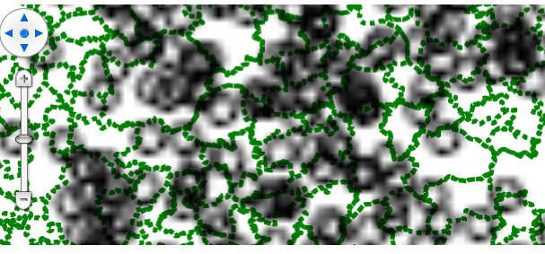
First, the layer will shown. But when I zoom, the WfsV2Overlay will never refreshed (see the picture). The same behavior with

string serviceLocationUrl = @"https://geoportal.umwelt.sachsen.de/arcgis/services/luft/ie_anlagenbestand_wfs/MapServer/WFSServer";
string typeName = "ie_anlagenbestand_wfs:Anlagenbestand_nach_IE-Richtlinie";

wfs

And when I try to get the Columnvalues, the Columns are created but with no Values.

   var source = layer.FeatureSource;
   try
   {
       source.Open();
       var features = source.GetAllFeatures(ReturningColumnsType.AllColumns);
       source.Close();
   }
   catch (Exception ex)
   {
       MessageBox.Show(ex.Message);
   }

Basically, I try to develop a module, that connects with the WFS Services and store the features in a database for offline use.
So I use WfsV2FeatureLayer as a base class and for every WFS Service that I have to use, I will develop a specialised class.

Please give me an advice, how to do that.

Regards Torsten

Hi Torsten,

Can you provide me more code snippet? For example what’re sridWfs, sridView in your code?

Thanks,
Ben

Hallo Ben,
thanks for your answer. The code is from a Wpf-Test project.

private void WfsLuisTierhaltung_Click(object sender, RoutedEventArgs e)
{
    var overlay = TisWfsHelper.CreateOverlayLUISSachsenTierhaltung(NetworkTools.Proxy, 25832, 25833);
    this.mapControl.Overlays.Add(overlay);
    _ = this.mapControl.RefreshAsync();
    this.mainWindowModel.MyOverlays.Add(new MainWindowModel.theOverlay() { IsVisible = true, MyOverlay = overlay });
}

public static TisWfsV2Overlay CreateOverlayLUISSachsenTierhaltung(IWebProxy proxy, int sridView, int sridWfs)
{
    var layer = TisWfsHelper.CreateLayerLUISSachsenTierhaltung(proxy, sridView, sridWfs);
    var overlay = new TisWfsV2Overlay()
    {
        FeatureLayer = layer,
        DrawingBulkCount = 500
    };
    return overlay;
}

static TisWfsV2FeatureLayer CreateLayerLUISSachsenTierhaltung(IWebProxy proxy, int sridView, int sridWfs)
{
    string serviceLocationUrl = @"https://luis.sachsen.de/arcgis/services/luft/tierhaltung_wfs/MapServer/WFSServer";
    string typeName = "tierhaltung_wfs:Tierhaltung";

    TisWfsV2FeatureLayer layer = new TisWfsV2FeatureLayer()
    {
        WebProxy = proxy,
        ServiceLocationUrl = serviceLocationUrl,
        TypeName = typeName,
        TimeoutInSeconds = 500
    };

    layer.ZoomLevelSet.ZoomLevel01.DefaultPointStyle = PointStyle.CreateSimplePointStyle(PointSymbolType.StarCircled, GeoColors.Black, 5);
    layer.ZoomLevelSet.ZoomLevel01.ApplyUntilZoomLevel = ApplyUntilZoomLevel.Level20;
    layer.FeatureSource.ProjectionConverter = new ProjectionConverter(sridWfs, sridView);

    var source = layer.FeatureSource;
    try
    {
        source.Open();
        var features = source.GetAllFeatures(ReturningColumnsType.AllColumns);
        source.Close();
    }
    catch (Exception ex)
    {
        MessageBox.Show(ex.Message);
    }
    return layer;
}

Regards Torsten

Hi Juergen,

I found some issues in the WfsV2FeatureLayer, please pull the latest beta 14.4.0-beta046 and here are some options for you:

  1. Use your existing code but don’t need to GetAllFeatures(), as following. This will fetch the data only for the current extent.
 static WfsV2FeatureLayer CreateLayerLUISSachsenTierhaltung(IWebProxy proxy, int sridView, int sridWfs)
 {
     string serviceLocationUrl = @"https://luis.sachsen.de/arcgis/services/luft/tierhaltung_wfs/MapServer/WFSServer";
     string typeName = "tierhaltung_wfs:Tierhaltung";

     WfsV2FeatureLayer layer = new WfsV2FeatureLayer()
     {
         WebProxy = proxy,
         ServiceLocationUrl = serviceLocationUrl,
         TypeName = typeName,
         TimeoutInSeconds = 500
     };

     layer.ZoomLevelSet.ZoomLevel01.DefaultPointStyle = PointStyle.CreateSimplePointStyle(PointSymbolType.StarCircled, GeoColors.Black, 5);
     layer.ZoomLevelSet.ZoomLevel01.ApplyUntilZoomLevel = ApplyUntilZoomLevel.Level20;
     layer.FeatureSource.ProjectionConverter = new ProjectionConverter(sridWfs, sridView);

     return layer;
 }
  1. Call GetAllFeatures() like what you are doing now, create a new InMemoryFeatureLayer and add all the returned features to InMemoryFeatureLayer.InternalFeatures. Instead of WfsV2Overlay, add that InMemoryFeatureLayer to a LayerOverlay or FeatureLayerWpfDrawingOverlay.

Have a try and let us know if you have other questions.

Thanks,
Ben