
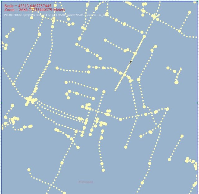
I can open a layer of major roads from a Postgres SQL database and display it on a map. The LineStyle works perfectly. However when I add a TextStyle my results are terrible. I usually do not see any road labels on the map. Upon occasion I may see one. I have played with several of the setting in the TextStyle and the only one that has any real effect is the TextLineSegmentRatio. The default value for this is .90. That makes sense. A value of 1 would allow a text label to stretch the full length of the line segment. A value of 0.90 would allow for the label to stretch most of the length of the line segment. In the attached image there are several Major Roads in the Austin,TX area drawn. I have changed the line style to display small dotted lines and LARGE dots on the line end caps. This way we can see the full length of the line segments. Where they begin and end. I also have a text style on the layer. TextLineSegmentRatio is set to 0.90. With line segments this LARGE I should have several labels. In the sample image you will notice that only 1 label is visible. I-35. That happens to be the largest line segment with the smallest label in this view.
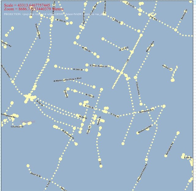
The second image show what happens when set the TextLineSegmentRatio to something crazy like 10.0. A LOT more labels appear. They do not follow the curves of the line segments even though AllowSpline is set to true.
The third attachment shows the TextStyle turned off and I have highlighted a five of the line segments with blue lines. The line segments are clearly long enough to fit labels. So I tried using some of the sample data sent with the ThinkGeo trail. The Austin minor roads shp files. They worked perfectly. The labels displayed exactly like they should with the 0.90 ratio set. The road data has even been broken down into very VERY small line segments. I am not overriding the TextStyle.DrawCore in any way in these examples. Any advice would be very appreciated.
