ThinkGeo Team,
I’ve implemented a ProjectionConverter for a RasterLayer (MrSid, GeoTiff, JPeg2000) using ThinkGeo.Core.UnmanagedProjectionConverter.
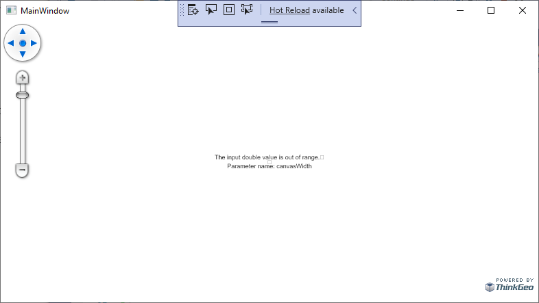
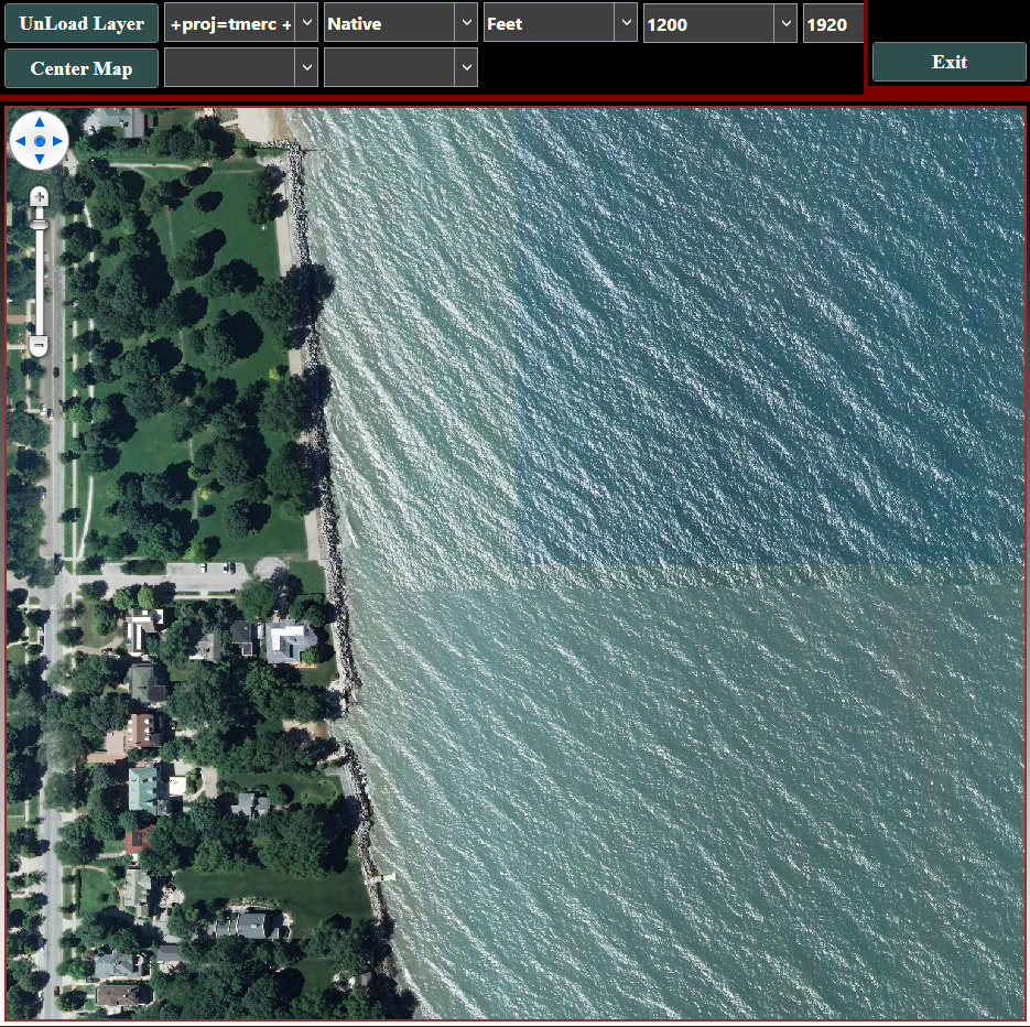
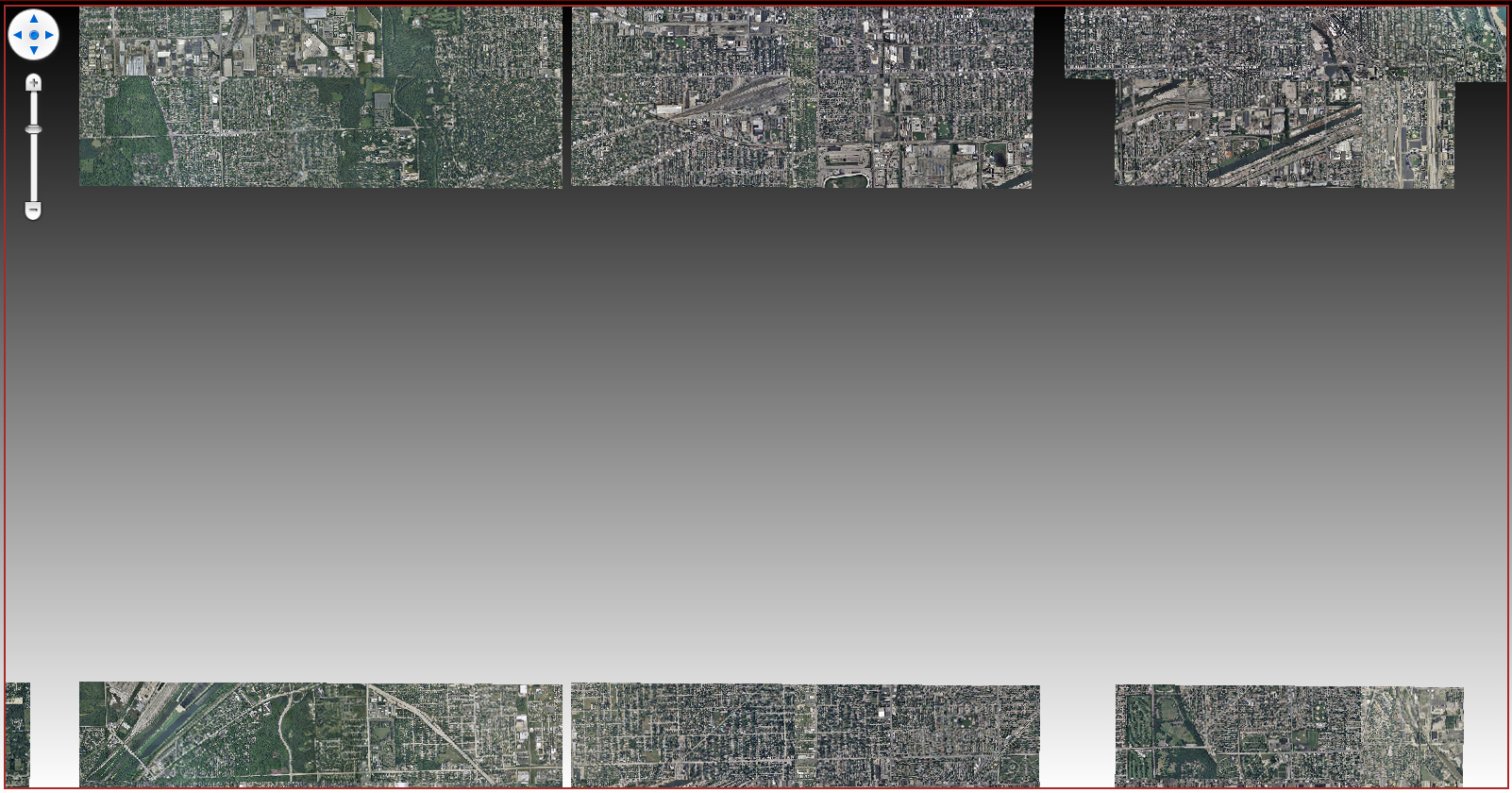
The initial rendering of the raster is fine, but as ZoomOut’s occur the rendering contains blank areas. The screen-captures below show this.
This is the code:
TheAssetsStatic.gProjectionConverterForRendering = new UnmanagedProjectionConverter(4326, 3857);
MrSidLayer = new MrSidRasterLayer();
MrSidLayer.ImagePath = ThePath;

TheAssetsStatic.aTheLayerOverlay.Layers.Add(MrSidLayer);
MrSidLayer.ImageSource.ProjectionConverter = TheAssetsStatic.gProjectionConverterForRendering;
This issue occurs for MrSid’s. I am still testing with GeoTiff and JPeg2000.
Testing with JPeg2000 results in no image at all being rendered.
Testing with GeoTiff results in same issue as shown in screen-captures below.
Thanks,
Dennis
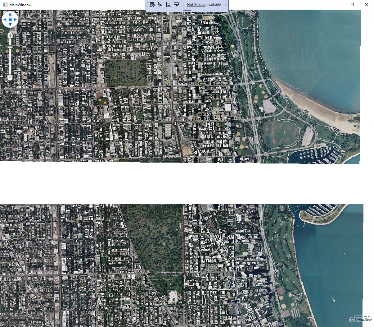
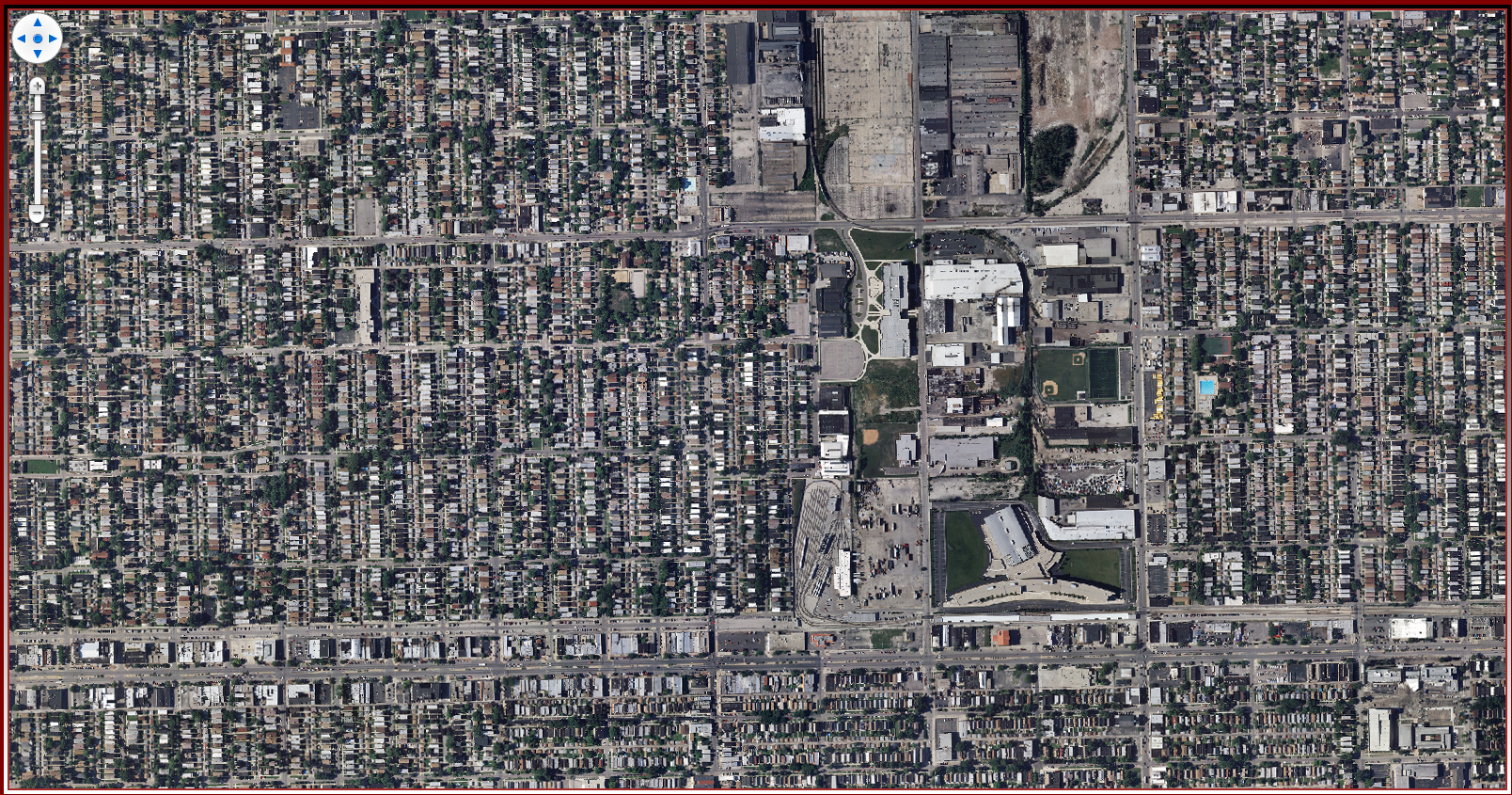
Initial rendering at ZoomLevel17

ZoomLevel16
ZoomLevel15
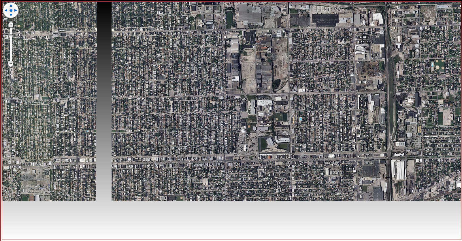
ZoomLevel14
ZoomLevel13
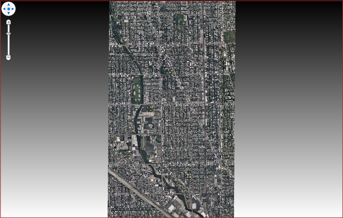
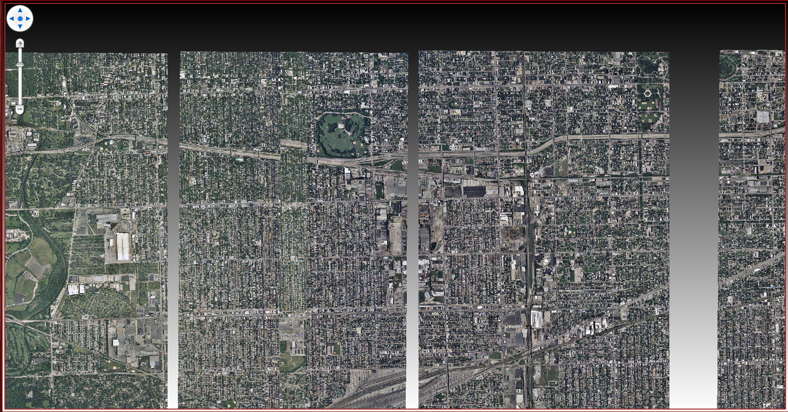
GeoTiff
ZoomLevel17
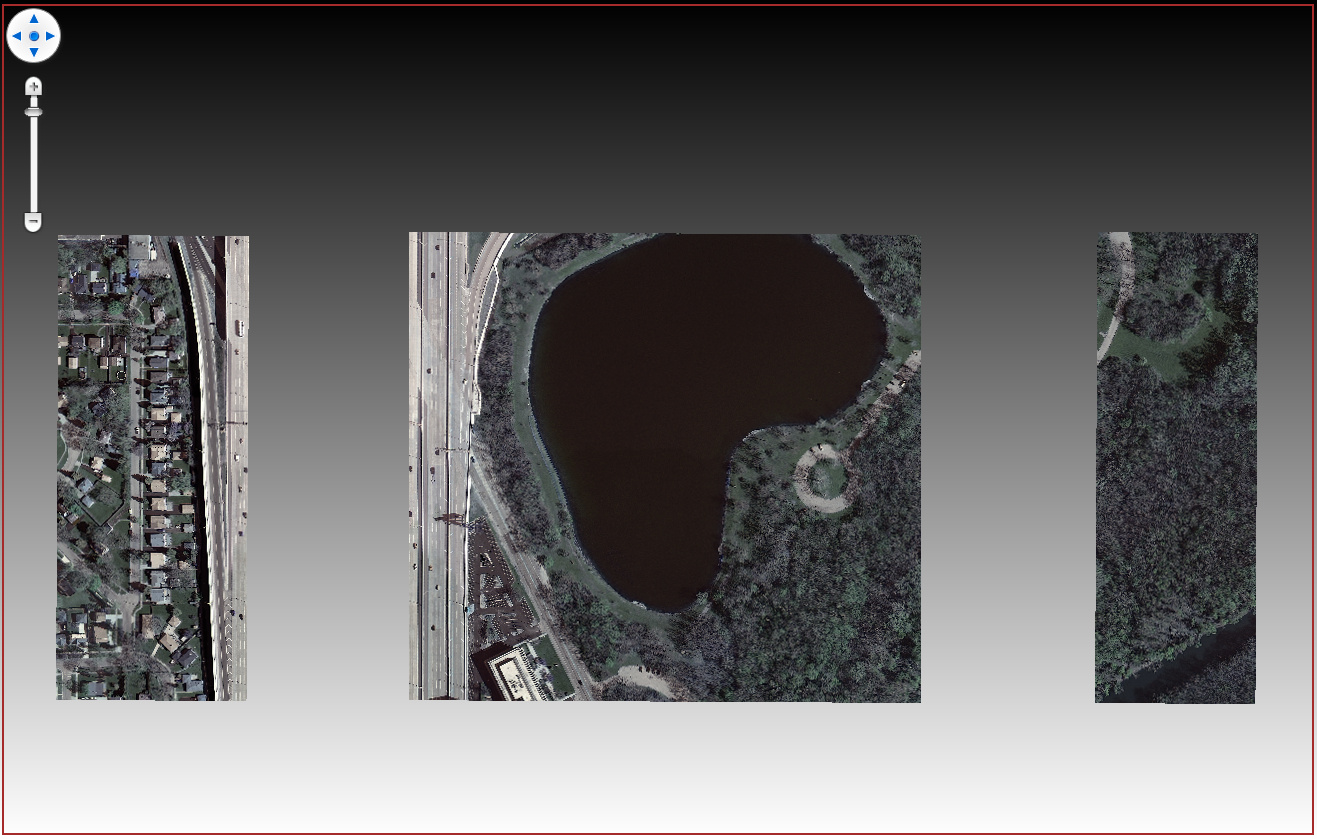
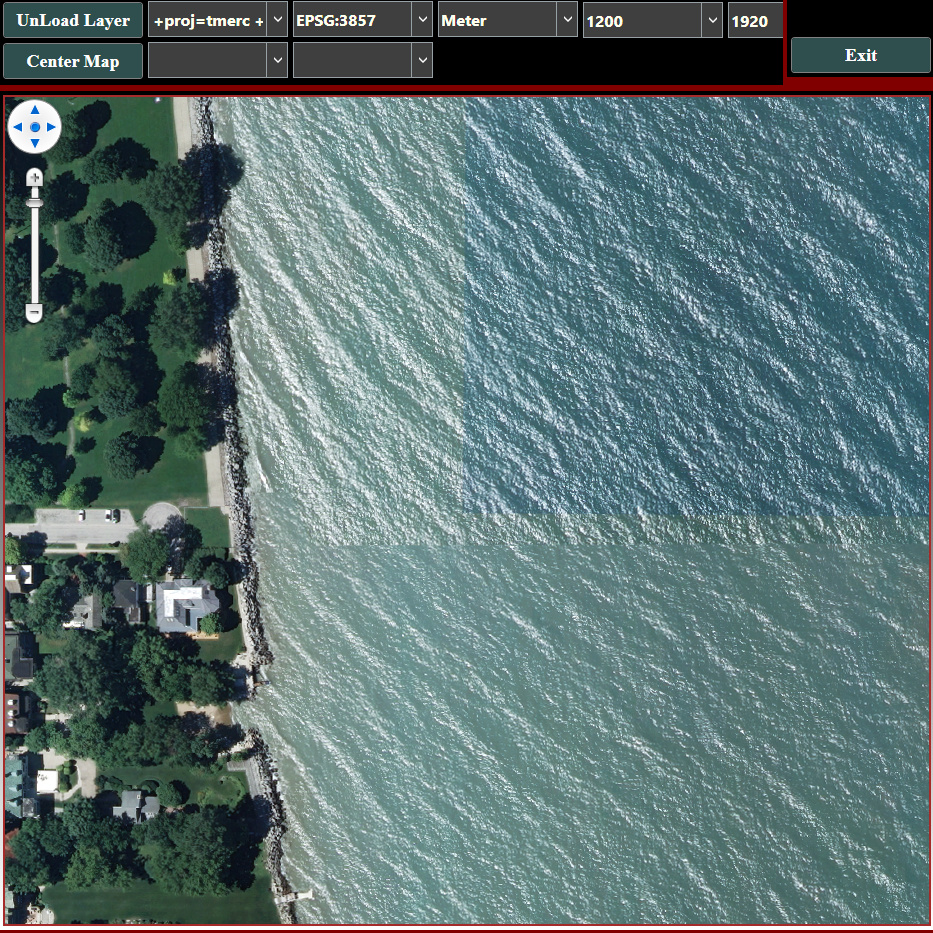
ZoomLevel17 - without ProjectionConverter