
Hi, we are trying to improve our interpolation method for creating contours. We just wanted to know which interpolation methods are most recommended for this, e.g. Kriging, IDW, etc.
What is the best interpolation method to use with ThinkGeo?
Thanks Alex,
IDW(InverseDistanceWeighted) is quick and simple, I would recommend it if generating the grids on the fly. Otherwise please go with Kriging which is more time consuming but the result is supposed to be smoother. check out here for more: https://en.wikipedia.org/wiki/Kriging.
Also you can implement your own interpolation method by inheriting from GridInterpolationModel class and overriding InterpolateCore method.
Please let us know if you have any more question.
Thanks
Frank
Hi Frank,
Thank you for your response, it was really helpful! Just a few more questions if you can help me with these:
- Do you know what the optimal setting is e.g. cell size for IDW and Kriging, or are these dependent on other inputs?
- What are the differences in terms of accuracy between the two methods?
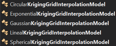
- Which kriging methods does Thinkgeo support? From what I can see, there are about 4 different types with each one consisting of a different method. I’ve read that universal kriging is the most accurate method to use…
Thanks,
Alex
Thanks Alex,
Here are our comments.
1, there’s no “optimal” settings, just different settings for different scenarios. Basically
a. the smaller the cell size is, the longer it takes to generate and the smoother the result contours will be.
b. for IDW, it has 2 major properties SearchRadius and Power. The bigger the SearchRadius is, the more points will be contributing to the current interpolation, which would take longer time and for some cases you might only want the current point be interfected by the nearby points, not too far away; The bigger Power is, the less a distant point affects the current intepolation.
2, I would say they are different, but it doesn’t mean one is more accurate than the other. Interpolation is just “guessing” values based on the existing values, different interpolations are just different ways of guessing, we can hardly say one way is more accurate than the other. We need to pick the proper one based on the current scenario.
Let us know if you have more questions.
Thanks
Frank
Hi Frank,
Very informative, really useful. Would you be able to clarify what exactly the cell size looks at when interpolating points?
Thanks,
Alex
Thanks Alex,
We need to generate grids from the isolated value points first before we can generate contour lines. The grids are a 2 dimention grid matrix, each grid has the fixed size and a value of its center point. The value can be the height of the territory for example, based on which we can generate isolines.
Here is a sample showing how to create isoline using Map Suite. This is based on v10 but it should be very easy to upgrade to v12 as well. let me know if you have any questions.
And here is the screenshot of that sample, to give you a general idea:
Thanks
Frank