ThinkGeo.com    |     Documentation    |     Premium Support

Wrong display of India national border

Hi @Ethan,

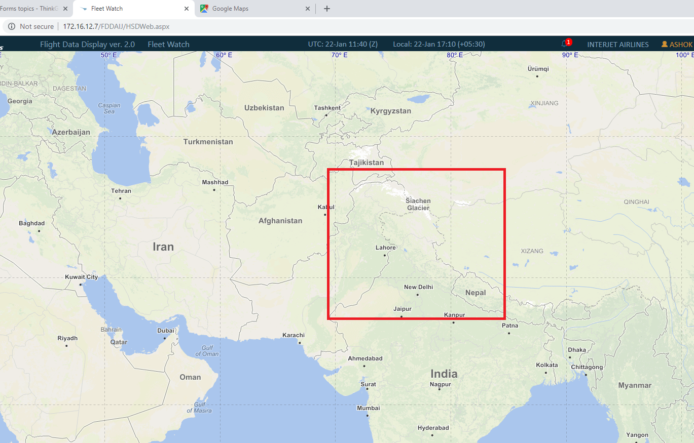
I am using “ThinkGeoCloudMapsOverlay” for displaying the Basemaps in my application. And its working fine.

But unfortunately the country border of INDIA is displaying wrongly. This is major issue. And it is observed and raised by my clients.

Where as I have checked in Google map, they are showing correctly, same we are expecting from Thinkgeo.

Please look into this issue, and provide me solution for this.

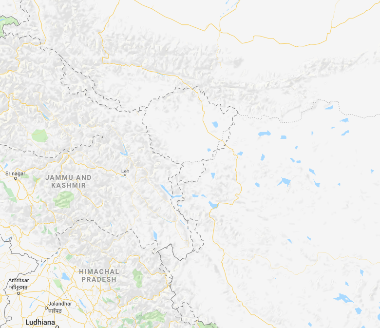
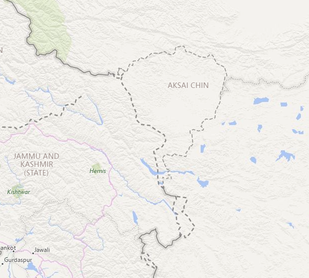
Please look at following wrong and correct plot of Country border.

Wrong one:

Correct one:

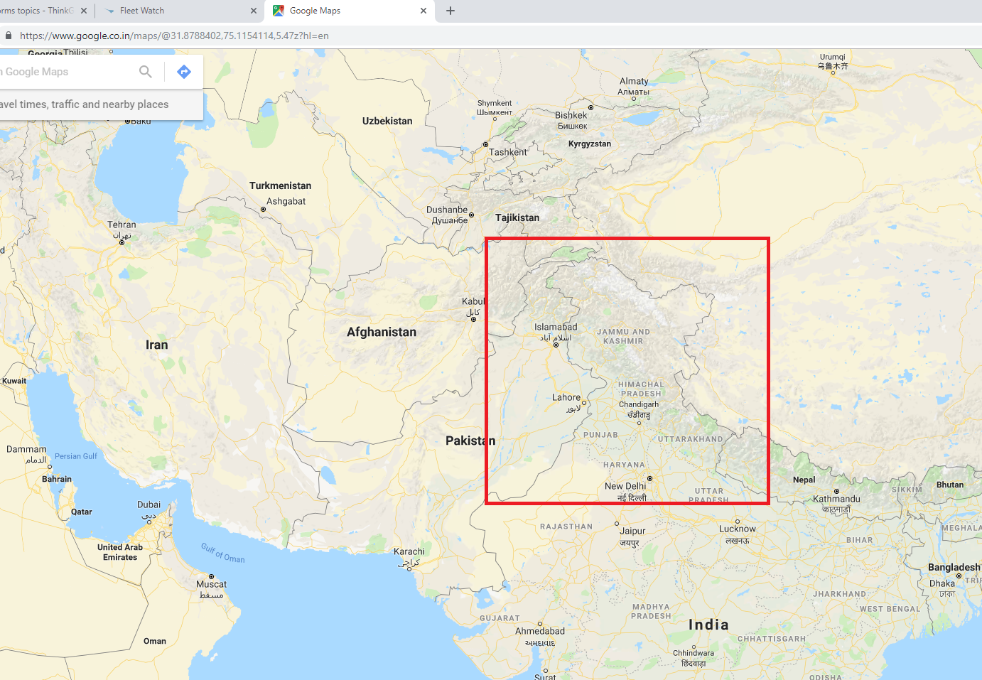
Ref : https://www.google.co.in/maps/@31.8788402,75.1154114,5.47z?hl=en

Thank you,
Ashok

Hi Ashok,

The data of ThinkGeoCloudMapsOverlay is come from OpenStreetMap, you can view it here:

And here is the result Google.com map(your screen shot is comes from Google.co.in map):
https://www.google.com/maps/@34.315847,79.1978693,6.83z

And here is the screen shot from Bing map:

It looks this part is named Aksai Chin, it’s a disputed area, I find it’s detail information here: https://en.wikipedia.org/wiki/Aksai_Chin

So if you think it’s a problem, you can build a shape which cover this part with different color and shows its name just like Google did.

Wish that’s helpful.

Regards,

Ethan